
Powering global climate simulations
"The fact that NeSI can provide support to things like getting the code to work puts New Zealand in an amazing position worldwide.”
Subject:
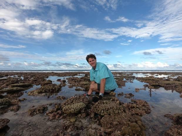
Dr. Eddie Beetham, a Research Fellow at the University of Auckland, is studying wave processes on coral reefs to understand the impact of sea level rise on coral reef islands. His work relies on access to NeSI, as his projects involve a combination of field measurements and modelling techniques. All simulations for his research featured below were computed on NeSI's Pan cluster, through the University of Auckland.
The following article, written by Jamie Morton, appeared in the New Zealand Herald on 04 November 2018.
- - - - - - - - - - -
Wave-driven flooding is soon expected to make many of the world's coral-fringed coastlines uninhabitable – and now Kiwi scientists have found a way to reveal which are most at risk.
Coral reefs provide a buffer to nearby low-lying communities, through breaking down the energy of waves and effectively regulating how they interact with shorelines.
This natural breakwater effect has also enabled dense urban development around coastal margins on many atoll islands, now extremely vulnerable to sea level rise.
Small and low-lying atoll islands were prone to flooding from spring tides, storm surge and wave "over-topping" - all of it predicted to become increasingly costly in the near future.
At present sea level, destructive flooding events happened every 10 to 30 years, allowing time to recover and rebuild.
But under projected sea level rise - average levels could be around a metre higher by the close of the century - wave-driven flooding events would happen so often they might force exposed areas to be abandoned.
Reef-fringed and atoll islands, alone, were home to nearly 200 million people.
In five nations in particular, more than 500,000 residents had little land to move to and could become climate change refugees.
The scale of the threat made it crucial to find which areas were most endangered.
University of Auckland researchers have devised a simple, accessible method to calculate threshold conditions for wave-driven flooding on reef coastlines, by comparing modelled flooding levels with two measures of island morphology.
Those two measures were relative reef width, which captured how effective the reef was at dissipating waves, and island elevation relative to offshore wave height.
By analysing some 60,000 simulations, they were able to find the point at which waves were likely to breach a coral island reef, which they dubbed the Reef Island Overtopping Threshold, or RIOT.
Their RIOT model was also tested against known flooding events on a number of different atoll islands.
"Our approach, using RIOT, will enable wide-scale and general assessments of island vulnerability, at present and future sea level, based on easily-measured morphological characteristics," study co-author Dr Eddie Beetham said.
"The simplicity of our method makes it broadly applicable to calculate threshold wave heights and sea levels associated with overtopping on different islands."
With this information, island nations would be able to plan for when and where flooding would strike in the future.
The research, co-authored by Professor Paul Kench, also of the university's School of Environment, further showed the impact of sea level rise wouldn't be the same everywhere.
"Sea level rise will have a compounding effect for coastal flooding on reef coastlines," Beetham said.
"The associated increase in reef depth will allow larger waves to reach islands, while the decrease in island height above sea level means that less energy is required for waves to overtop the shoreline."
Islands with maximum shoreline elevation less than 1.5m above spring high tide would be significantly more prone to future overtopping, even if positioned on a shallow and wide reef that effectively dissipates wave energy at present sea level.
On these lower islands, Beetham said, wave overtopping would occur more frequently even with just 10cm to 40cm of sea level rise.
Their study has been published in major scientific journal Nature Communications.
---------------------
Do you have an example of how NeSI platforms have supported your work? We’re always looking for projects to feature as a case study. Get in touch by emailing support@nesi.org.nz.


